
Summary
The shortlist of free photogrammetry software worth using in 2026 is smaller, and more nuanced, than many roundups suggest. RealityScan belongs on that shortlist, but only with precise wording: it is proprietary, and a seat subscription is required unless an exception applies under its EULA and licensing terms. [1] [2]
The best pick depends on the deliverable. For object scanning on a Windows workstation, RealityScan and Meshroom are the most practical mainstream options, but they differ sharply in licensing and GPU assumptions. [2] [4] [7] [8] For drone mapping and terrain products, OpenDroneMap and WebODM make more sense because they are built around orthophotos, DEMs, and georeferenced outputs rather than just textured meshes. [14] [15] [18] For research, scripting, or reproducible pipelines, COLMAP and MicMac remain strong baselines. [12] [13] [20] [21] For Apple-native AR workflows, RealityKit Object Capture is its own category: an Apple-specific API and tooling path centered on PhotogrammetrySession and USDZ output. [22] “Free” does not automatically mean open source. [1] [19]
Quick comparison table
This comparison separates four different “free” buckets: open-source software, proprietary software that is free only under stated exceptions, personal-use freeware, and Apple’s platform-specific API workflow. That matters because download cost tells you very little about licensing, hardware compatibility, export goals, or whether a tool is meant for object capture or geospatial mapping. The table below is not an accuracy ranking, and it deliberately excludes time-limited trials and paid-only suites. [1] [2] [12] [14] [19] [22]
| Tool | Best for | Free status | Main limitation |
|---|---|---|---|
| RealityScan | Object photogrammetry, especially Windows-based asset and scan workflows. | Proprietary; seat required unless exception applies. [1] [2] | Licensing depends on revenue and use case, and full reconstruction has GPU constraints. [1] [4] |
| Meshroom | Object photogrammetry with a visual node workflow. | Open source; CUDA NVIDIA recommended; Draft Meshing fallback. [7] [8] | No official macOS release, and full reconstruction is much less practical without supported NVIDIA hardware. [8] |
| COLMAP | Research, reproducible SfM/MVS baselines, GUI or CLI workflows. | Open source (BSD). [12] | More technical setup, and default packages may omit CUDA or HIP/ROCm support. [13] |
| OpenDroneMap (ODM) | Mapping-first jobs: orthophotos, DEMs, georeferenced outputs. | Open source mapping-first; orthophoto/DEM outputs. [14] [15] | Practical limits are driven by RAM, dataset size, and mapping workflow assumptions. [14] |
| WebODM | Easier mapping workflow management for aerial projects. | Open source; not ODM UI; uses ODX per repo note. [18] | Best judged as a mapping product, not as a tabletop object-mesh tool. [18] |
| 3DF Zephyr Free | Learning photogrammetry and very small personal object projects. | Personal use; 50-image cap. [19] | Hard project cap and personal-use licensing. [19] |
| MicMac | Expert photogrammetry, surveying-minded, research-heavy workflows. | Open source; expert workflow. [20] | Steeper learning curve than consumer-style tools. [20] [21] |
| Apple Object Capture | Apple-native capture-to-AR pipeline. | Apple RealityKit API; USDZ-centered workflow; hardware limits. [22] | Apple-only workflow and not a general cross-platform desktop app. [22] [23] |
Best picks by use case
The most useful shortlist starts with the output you need, not the word “best.” A printable reference mesh, a game-ready textured asset, a reproducible research pipeline, and a drone orthomosaic are different jobs with different constraints. The real question is which tool fits your hardware, license situation, and deliverable. [12] [15] [18] [19] [22]
- Tabletop objects on a Windows workstation: RealityScan or Meshroom, because both are aimed at object reconstruction rather than map products. [4] [7] [8]
- 3D-printing reference meshes: RealityScan if you want broad export options including STL, or 3DF Zephyr Free if the project fits inside its 50-photo or 50-frame cap. [6] [19]
- Game or VFX props: Meshroom if you want an open-source node workflow, or RealityScan if its licensing and hardware model fit your situation. [1] [7] [8]
- Cultural-heritage documentation with method transparency: COLMAP or MicMac, because they map well to research-style, inspectable workflows. [12] [20] [21] [29]
- Drone orthomosaics: OpenDroneMap or WebODM, because orthophotos are first-class outputs there. [15] [18]
- DEM and terrain products: OpenDroneMap or WebODM, because DSM and DTM outputs are part of the mapping stack rather than an afterthought. [15] [18]
- Education and reproducible research: COLMAP for a clean open baseline, and MicMac for deeper photogrammetric control. [12] [20] [21]
- Apple AR and USDZ delivery: RealityKit Object Capture, because the workflow is designed around
PhotogrammetrySessionand USDZ output. [22] - Fast personal experimentation with tiny datasets: 3DF Zephyr Free, because it is easy to try, but only for personal use and only within the hard cap. [19]
What “free” really means here
In this category, “free” covers several licensing models. Open-source tools such as COLMAP, OpenDroneMap, Meshroom, MicMac, and WebODM give you source access and license-defined reuse rights, even though their obligations differ. [10] [12] [17] [18] RealityScan is different: it is proprietary software with a seat model, and the seat requirement is waived only when an exception applies. The EULA defines one major exception as less than $1,000,000 USD in gross revenue over the last 12 months across the corporate group, and it says that revenue includes advances received or other funds raised. [1] 3DF Zephyr Free is different again: it is freeware for personal use, not an open-source package and not a blanket commercial-use license. [19] Apple Object Capture is also its own bucket, because it is an Apple API and tooling workflow, not a normal cross-platform desktop product. [22]
Here, “worth using” means the tool is actively available to download now, produces practical deliverables in standard formats, has documented constraints from primary sources, and fits a real workflow such as object capture, VFX assets, 3D-printing prep, or geospatial output. [6] [14] [15] [22] That standard also forces a distinction between hard caps and practical limits. A hard cap is something like 3DF Zephyr Free’s 50-photo or 50-frame project limit. [19] A practical limit is something like OpenDroneMap’s RAM scaling guidance or Meshroom’s dependence on supported NVIDIA CUDA hardware for its normal reconstruction path. [7] [8] [14]
Technical principles
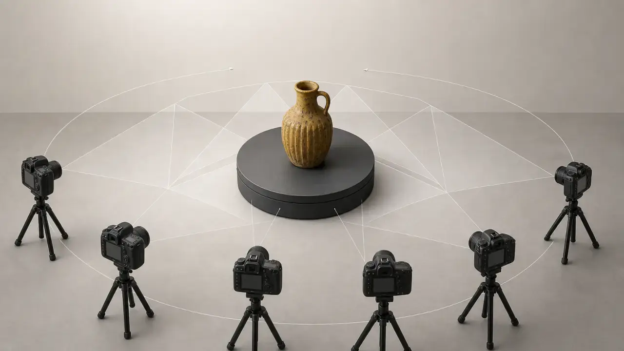
Photogrammetry starts by finding visual features that repeat across overlapping images, matching them, and estimating where each camera was when each image was taken. Good overlap and stable scene geometry matter because the software is solving relationships across many views, not inferring a model from a single photo. [29] [30]
Structure from Motion, or SfM, is the stage that turns those image matches into a sparse 3D reconstruction and a set of camera poses. In practical terms, SfM answers two early questions: where the cameras were, and which image features correspond to the same physical points in space. Modern pipelines then refine that estimate through bundle adjustment so the camera network fits together as consistently as possible. That is why alignment quality depends so much on overlap, viewpoint diversity, and stable image content. [29]
Multi-View Stereo, or MVS, comes after that sparse solution. MVS densifies the reconstruction by estimating surface information from multiple aligned views, creating a much richer point cloud or surface estimate than the sparse SfM stage alone. From there, software can build a mesh and project color information back onto it for texturing. That is the basic path behind most of the tools in this article, even if their interfaces and intended outputs differ between object scanning and mapping. [30] [31]
Accuracy and validation: don’t confuse “looks good” with “measures right”
A model can look excellent and still be dimensionally wrong. Internal fit metrics such as reprojection error tell you something about how well image observations fit the estimated camera geometry, but they do not by themselves prove external dimensional accuracy in real-world units. To move from a coherent reconstruction to trustworthy measurement, you need scale information, control, reference geometry, or georeferencing, depending on the job. In object capture, that may mean a scale bar or known reference distance. In mapping, it may mean surveyed control or a georeferencing workflow such as ODM’s gcp input. Repeatability matters too: if you cannot rerun the workflow and get consistent results, attractive output alone is not enough. [16] [25] [26]
The standards cited here are vocabulary and boundary references, not badges for any tool in this list. ISO 5725-1 frames accuracy in terms of trueness and precision, the VIM defines the core measurement vocabulary, and ISO 10360-13 addresses acceptance and reverification tests for optical 3D coordinate measuring systems when measuring lengths as stated by the manufacturer. None of that means the tools in this roundup are ISO-compliant for metrology use by default. [24] [25] [26]
- Accuracy: Closeness of a result to a reference value, discussed through trueness and precision. [25] [26]
- Trueness: Closeness of the mean of repeated results to a reference value. [25] [26]
- Precision / repeatability: Closeness of repeated results to each other under stated conditions. [25] [26]
- Resolution / detail: How much fine surface structure is represented, which is not the same thing as dimensional correctness. [26]
- Reprojection error: An internal image-fit indicator, not a standalone proof of real-world accuracy. [25] [26]
- Scale / georeferencing: The step that ties a reconstruction to known dimensions or a coordinate system. [16] [26]
Workflow: from photos to usable outputs
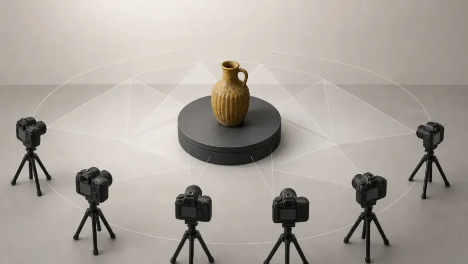
Capture discipline matters more than the download button. Plan the subject, the background, the downstream deliverable, and whether you need real-world scale before you take a single shot. Overlap is one of the key variables: Apple’s Object Capture guidance recommends about 70% overlap between adjacent views and warns that below 50% overlap the process may fail or produce lower-quality results. [23] Keep exposure, focus, and focal length as consistent as possible, avoid motion blur, and use masking or a simple background when stray scene detail might confuse matching. Stable, non-deforming subjects are easier than reflective, transparent, or flexible ones. [23]
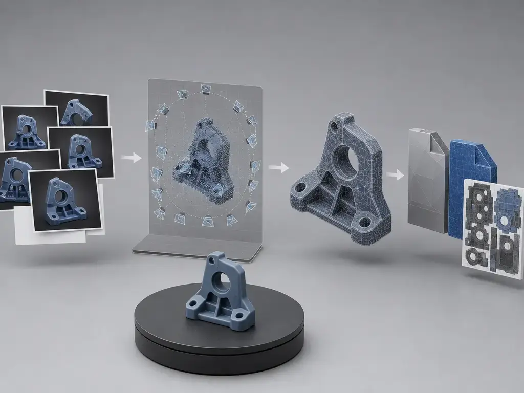
Choose outputs by job, not habit. For 3D printing, a cleaned mesh often ends up as STL. For textured assets, common targets include OBJ, GLB, or USDZ. RealityScan’s export list includes OBJ, PLY, XYZ, ABC, GLB, STL, 3MF, USD, USDZ, PTX, LAS, FBX, DXF, and DAE. [6] For point-cloud work, PLY, LAS, and LAZ matter more. For mapping, GeoTIFF orthophotos and DEMs are the main products, and ODM documents georeferenced point clouds, textured OBJ meshes, GeoTIFF orthophotos, and DSM/DTM outputs. [15] In Apple’s workflow, the expected baseline output is USDZ. [22]
- Plan the deliverable and decide whether you need a printable mesh, textured asset, point cloud, or geospatial raster.
- Shoot with strong overlap from enough angles to cover the subject, aiming for about 70% overlap between neighboring views. [23]
- Mask or simplify the background if the scene contains distracting detail or clutter.
- Align the images so the software can estimate camera positions and sparse structure.
- Generate the dense reconstruction after alignment succeeds.
- Create the mesh from the dense result.
- Texture or color the model if the downstream use needs surface appearance.
- Clean up and decimate the mesh for printing, viewing, or real-time use.
- Export the right format and preserve metadata when needed; for RealityScan round-tripping, the optional
.rsinfofile stores coordinate-system and export-parameter information, and skipping it can cause a reimported model to come back shifted, rotated, or scaled relative to the cameras. [6]
Tool notes: when each free option is worth using
RealityScan
RealityScan is best for object photogrammetry when you want a mature desktop workflow with broad export coverage and you are comfortable with a proprietary license model. A seat subscription is required unless an exception applies, and the small-business or personal exception is tied to less than $1,000,000 USD gross revenue over the last 12 months across the corporate group, including advances or other funds raised. Above that threshold, the listed price is $1,250 per seat per year. [1] [2] Hardware remains important: image registration can run without a compatible NVIDIA GPU, but model and texture creation cannot, although RealityScan 2.2 added AMD GPU support on Windows on June 24, 2026. [4] [5] Export options are unusually broad, and .rsinfo helps preserve coordinate context. [6] Avoid it if you need open-source licensing or a workflow with no license-condition ambiguity. [1]
Meshroom (AliceVision)
Meshroom is worth using when you want an open-source, visual, object-photogrammetry workflow rather than a mapping suite. The project is open source under MPL 2.0, and the current stable release listed on the official releases page is Meshroom 2025.1.0 from 2025-08-18. [7] [10] The main catch is hardware: the official project page says the binaries are built with CUDA-12 and compatible with compute capability 5.0 or higher, and without a supported NVIDIA GPU only Draft Meshing can be used for 3D reconstruction. [7] [8] There is also no official macOS release. [8] In practice, it works well for maker, prop, and learning workflows centered on mesh reconstruction. Avoid it if you need full-capability reconstruction on non-NVIDIA hardware or an official Mac build. [8]
COLMAP
COLMAP is worth using when you want a research-grade baseline for SfM and MVS, especially if you value inspectable steps, scripting, and repeatable pipelines. It is open source under the new BSD license, with a reminder that third-party dependencies can affect the overall licensing picture of a built setup. [12] COLMAP can be used through both the command line and the graphical user interface, but the installation docs warn that default Linux, Unix, and BSD packages may not include CUDA or HIP/ROCm support, which requires a manual build from source. [13] The output angle here is less one-click final asset and more a strong reconstruction core you can integrate into a larger workflow. Avoid it if you want a beginner wizard or a turnkey consumer experience. [13]
OpenDroneMap (ODM)
OpenDroneMap is worth using when the real output is a map product, not just a mesh. The official docs describe the ecosystem as free and open source, while also noting that paid installers exist as a convenience. [14] Its minimum hardware guidance is modest on paper, with a 64-bit CPU from 2010 or later and 4 GB RAM, but the same page warns that only about 100 to 200 images fit that minimum before memory runs out, and it says the GPU currently has no impact on performance. [14] ODM’s strength is output taxonomy: georeferenced point clouds in .ply, .laz, or .csv, textured meshes in .obj, GeoTIFF orthophotos, and DSM/DTM products when enabled. [15] It also supports a gcp argument for ground control input and is licensed under AGPLv3. [16] [17] Avoid it if your primary job is small-object asset capture rather than mapping deliverables. [15]
WebODM
WebODM is worth using when you want a more user-facing mapping product around aerial-image processing. Its repository is explicit on two points that matter here: WebODM is licensed under AGPL-3.0, and it says it is not affiliated with OpenDroneMap, is not a user interface to OpenDroneMap, and uses ODX for processing. [18] That means it should be evaluated as its own mapping workflow, not described as ODM with a GUI. The relevant outputs are still mapping-oriented, such as maps, point clouds, elevation models, and textured 3D models from aerial imagery. [18] Avoid it if your comparison criterion is the best-looking object mesh, or if you assume it is merely a thin front end over ODM. [18]
3DF Zephyr Free
3DF Zephyr Free is worth using when you want to learn photogrammetry or process very small personal projects without paying upfront. The key caveat is licensing: the official product page calls it a completely free version for personal use, which is not the same thing as open source or unrestricted commercial use. [19] The other hard boundary is project size: you can use up to 50 photos or 50 video frames per project. [19] That cap makes it realistic for small objects, test scans, and first experiments, but not for larger or more demanding datasets. It can still serve as a simple object-scan and viewing tool within those bounds. Avoid it if you need commercial-use certainty or if your normal projects exceed the 50-image or 50-frame limit. [19]
MicMac
MicMac is worth using when you want a serious photogrammetric suite with institutional roots and a method-first mindset. The project README says MicMac is developed at IGN and ENSG within the LASTIG lab and has been distributed under the CeCILL-B license since 2007, while an ISPRS paper gives the broader context that development dates back to 2003 and free distribution began in 2007. [20] [21] This is not the shortest path to a polished consumer workflow, but it is valuable for rigorous reconstruction, control-heavy projects, and research environments where understanding the process matters as much as the final mesh. It also suits metrology-minded workflows where validation is expected, not assumed. Avoid it if you want the fastest beginner experience. [20] [21]
Apple Object Capture (RealityKit PhotogrammetrySession)
Apple Object Capture is worth using when your pipeline already lives in Apple’s ecosystem and your target is AR-ready output rather than a general-purpose desktop photogrammetry tool. Apple documents the workflow through RealityKit and PhotogrammetrySession, with the baseline object-creation path producing a USDZ file. [22] This is the clearest example of an API workflow in this roundup: availability is limited to Macs that meet Object Capture requirements, including a GPU with at least 4 GB of RAM and ray tracing support, and Apple also notes availability on select LiDAR-capable iOS devices. [22] Capture quality still depends on overlap and scene discipline, and Apple says depth data can help compute real-world size; without it, you may need to scale the result later. [23] Avoid it if you need cross-platform photogrammetry, mapping outputs, or a conventional Windows desktop application. [22]
Performance and practical limits that matter
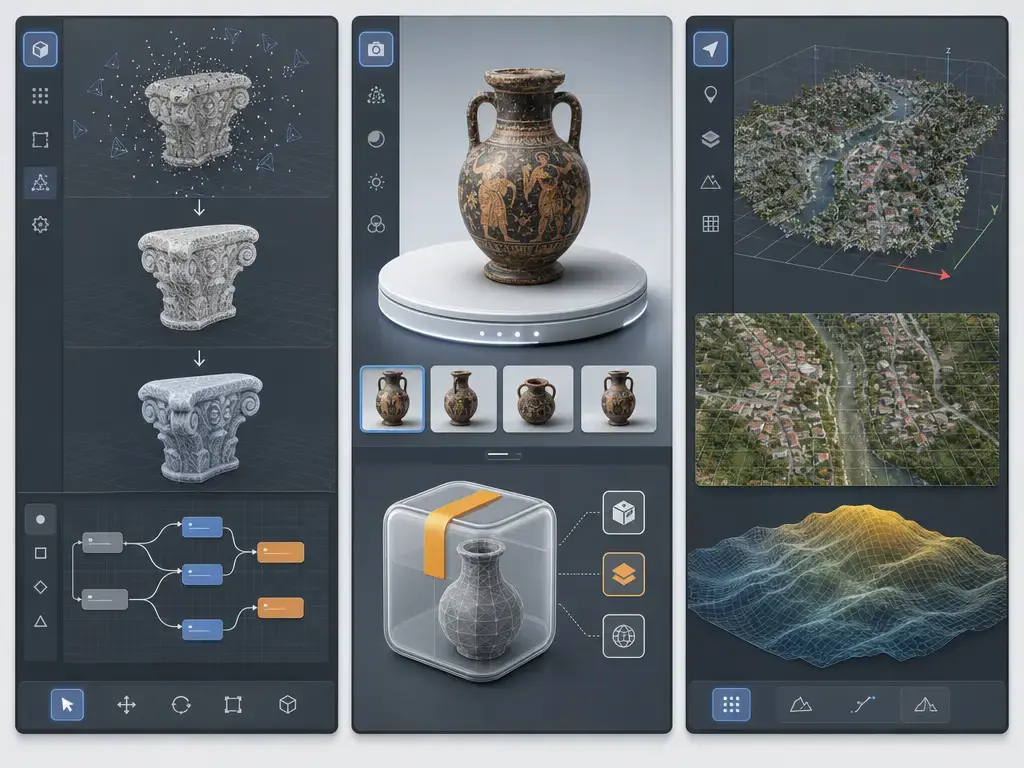
The most important limits are rarely the headline feature. Some are hard caps, such as 3DF Zephyr Free’s maximum of 50 photos or 50 video frames per project. [19] Others are soft hardware limits, where the software runs but only within small datasets or slow settings. OpenDroneMap’s docs are unusually concrete here: 40 images → 4 GB RAM, 250 → 16 GB, 500 → 32 GB, 1500 → 64 GB, 2500 → 128 GB, 3500 → 192 GB, and 5000 → 256 GB. [14] A third category is dataset-dependent limits. Bad overlap, blur, low texture, rolling-shutter distortions, reflective surfaces, and inconsistent lighting can all sink a project long before an official minimum-spec page becomes relevant. [14] [19] [23]
It also helps to separate specification sheets from benchmarks. A vendor page listing many export formats does not mean the tool is faster, more accurate, or better on your subject. Likewise, a minimum-spec page only tells you what may launch, not what will be pleasant or efficient on your dataset. Fair speed comparisons require the same image set, the same hardware, and comparable settings across tools. [3] [6] [14]
Practical factors that usually matter more than branding include:
- Overlap percentage and viewpoint coverage. [23]
- Sharpness and motion blur.
- Texture richness on the surface being captured.
- Lighting consistency and control of highlights.
- Rolling shutter and flight geometry in drone work.
- Masking needs and background complexity. [23]
- Processing settings such as depth-map quality, image downscale, and meshing choices.
Limitations: when photogrammetry is the wrong tool
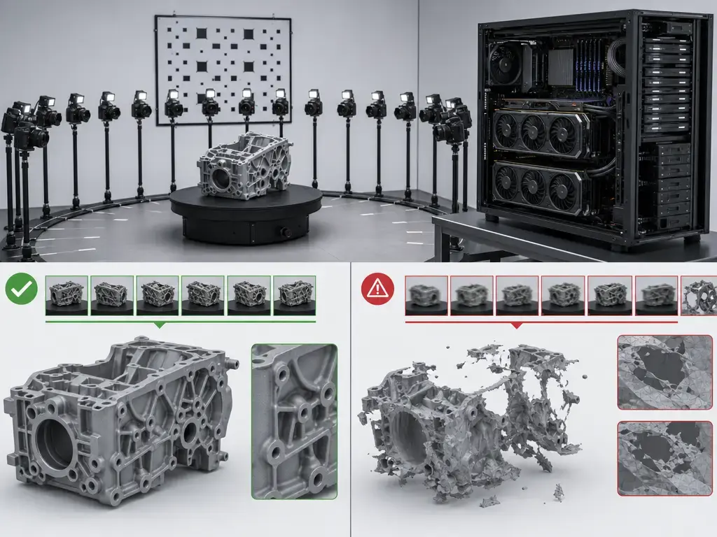
Photogrammetry is a weak fit for reflective, transparent, glossy, deforming, moving, or highly repetitive subjects. Glass, polished metal, leaves in wind, and uniform patterned surfaces all create matching problems that no free label fixes. [23]
It is also the wrong tool when you need dimensions but do not have a scale strategy. A reconstruction from ordinary photos has no guaranteed real-world size unless you introduce known scale, control, or georeferencing. Even when the geometry is broadly correct, the output may need cleanup, hole filling, simplification, texture repair, or coordinate-system work before it is useful downstream. In drone mapping, the meaning of accuracy changes once you care about map coordinates and terrain products, because georeferencing and control become part of the workflow rather than an optional extra. [16] [24] [25] [26]
There are also privacy, property, and site-access issues whenever you photograph people, private spaces, or sensitive locations, even if the software itself is free. Keep that legal note high level, but do not ignore it. More importantly, do not sell photogrammetry output as metrology by default: measurement accuracy is a validation problem, not a visual impression, and none of the tools here should be treated as ISO-certified measurement systems out of the box. [24] [25] [26]
Historical and research context
Photogrammetry is older than the current software market by well over a century. ISPRS states that the term photogrammetry first appeared in published work in 1867, that the International Society for Photogrammetry was founded in 1910, and that it was renamed ISPRS in 1980. [27] A useful nuance is that Aimé Laussedat was already using photographic images for topographic surveys as early as 1861 through what he called metrophotography, which is why “father of photogrammetry” claims often need context. [28]
Modern free tools exist because the computational foundations became more accessible and more automatable. The 2016 CVPR paper Structure-From-Motion Revisited describes an SfM technique whose full pipeline was released as an open-source implementation, and the 2010 TPAMI paper by Furukawa and Ponce remains a classic MVS reference. [29] [30] By 2012, applied literature such as Westoby et al. had already helped normalize SfM photogrammetry as a practical, low-cost approach in geoscience and terrain modeling, which is part of the broader story behind today’s open and low-cost tools. [31]
Current market context
One meaningful market change in 2026 is that licensing and hardware compatibility have become easier to separate when evaluating RealityScan. The licensing page still makes the commercial boundary explicit at over $1,000,000 USD gross annual revenue, with listed pricing of $1,250 per seat per year above that threshold, but the June 24, 2026 release of RealityScan 2.2 added AMD GPU support on Windows, with Linux support described as coming later. [2] [5] That does not make the tool open source or universally free, but it does make the hardware conversation less NVIDIA-only than it used to be. [1] [5]
Adjacent methods such as NeRFs and Gaussian splatting matter, but they are outside this comparison because they optimize for different representations and viewing assumptions. They are not the same thing as a mesh-first photogrammetry workflow that targets STL, OBJ, PLY, orthophotos, or DEMs.
Conclusion: which free photogrammetry software is worth using?
If you are asking which free photogrammetry software is worth using, the practical answer is still role-based. For general object scanning on Windows, RealityScan and Meshroom are the strongest mainstream picks, with the choice driven mostly by licensing and GPU realities. [1] [2] [7] [8] For research and reproducible pipelines, start with COLMAP and look at MicMac when you want deeper photogrammetric control. [12] [13] [20] [21] For drone mapping and terrain products, choose OpenDroneMap or WebODM because they are built around geospatial deliverables rather than just object meshes. [15] [18] For Apple-native AR output, Object Capture is the right answer precisely because it is not pretending to be a generic cross-platform app. [22]
The common mistake is choosing by price label alone. Pick by workflow, deliverable, hardware, and license terms. A personal-use freeware tool is not the same as open source, and a proprietary exception-based license is not the same as a fully free commercial-use baseline. [1] [19]
FAQ
What is the best free photogrammetry software?
There is no single best choice across every workflow. For object scans on a Windows PC, RealityScan and Meshroom are the most practical mainstream options, but one is proprietary with exception-based free use and the other is open source with strong NVIDIA/CUDA assumptions. [1] [2] [7] [8] For research, COLMAP is a very strong baseline. [12] [13] For mapping, OpenDroneMap or WebODM usually make more sense because they target orthophotos, point clouds, and DEMs rather than just small-object meshes. [15] [18]
Is there open source photogrammetry software?
Yes. COLMAP is open source under the new BSD license. [12] Meshroom is open source under MPL 2.0. [10] OpenDroneMap is open source under AGPLv3, WebODM is AGPL-3.0, and MicMac is distributed under CeCILL-B. [17] [18] [20] The follow-up question is whether the tool matches your workflow: COLMAP suits research, ODM suits mapping, Meshroom suits visual object workflows, and MicMac suits expert photogrammetry. [8] [13] [15] [20]
Which photogrammetry software is free for commercial use?
Open-source tools can be used commercially if you comply with their licenses, but the obligations differ. ODM explicitly says it is AGPLv3 and that you may build and sell applications with it as long as you comply with the license terms. [17] WebODM is AGPL-3.0 as well. [18] RealityScan is not commercially free in a blanket sense: its seat requirement is waived only when an exception applies, and above the threshold the listed price is $1,250 per seat per year. [1] [2] 3DF Zephyr Free should not be treated as general commercial-use software because the official page frames it as personal use. [19]
Do I need an NVIDIA GPU for photogrammetry?
Not always, but some tools strongly assume one. Meshroom’s official page says that without a supported NVIDIA GPU, only Draft Meshing can be used for 3D reconstruction. [8] RealityScan’s documentation says the application can perform image registration without a compatible NVIDIA GPU, but it cannot create models or textures without one, although RealityScan 2.2 added AMD GPU support on Windows in June 2026. [4] [5] OpenDroneMap is different again: its docs say the GPU currently has no impact on performance. [14]
Can free photogrammetry software make STL files for 3D printing?
Yes, but usually after cleanup. RealityScan explicitly lists STL among its export formats. [6] Other tools may require an extra cleanup or conversion step depending on how you finish the mesh. The real issue is not just whether it can export STL, but whether the reconstructed mesh is watertight, scaled correctly, and simple enough for your slicer. For very small personal projects, 3DF Zephyr Free can be useful, but remember its hard cap of 50 photos or 50 video frames per project. [19]
Expert: What does reprojection error tell me—and what doesn’t it tell me about real-world accuracy?
Reprojection error is an internal consistency metric. It tells you how well the estimated cameras and 3D points explain the image observations inside the reconstruction. What it does not do is prove that the final model is dimensionally correct in external units. For that, you need scale, control, reference geometry, or georeferencing, plus repeatable validation. ISO and VIM terminology is helpful here because it separates accuracy, trueness, and precision instead of collapsing everything into one vague “good scan” idea. [25] [26]
Expert: How do GCPs and georeferencing change what “accuracy” means in drone mapping workflows?
Once you move into drone mapping, accuracy often shifts from object-shape plausibility to coordinate-system meaning. Ground control points and georeferencing tie the reconstruction to known positions, which changes the conversation from internal model fit to externally referenced spatial products. ODM exposes this directly through its gcp argument for a ground control point file. [16] That still does not guarantee accuracy by itself, but it makes validation against surveyed reference data possible in a way that an unscaled object mesh does not. [24] [25] [26]
Sources
- RealityScan EULA. https://www.realityscan.com/eula
- RealityScan licensing. https://www.realityscan.com/license?lang=en-US
- RealityScan download + minimum requirements. https://www.realityscan.com/download
- RealityScan hardware/software requirements (Epic docs). https://dev.epicgames.com/documentation/realityscan/hardware-and-software-requirements
- RealityScan 2.2 AMD GPU support. https://www.realityscan.com/news/realityscan-2-2-is-here-with-full-amd-gpu-support-download-today
- RealityScan export formats + rsinfo. https://rshelp.capturingreality.com/en-US/tools/export.htm
- Meshroom releases. https://github.com/alicevision/meshroom/releases
- Meshroom official project page. https://alicevision.org/view/meshroom.html
- Meshroom Draft Meshing wiki. https://github-wiki-see.page/m/alicevision/meshroom/wiki/Draft-Meshing
- Meshroom GitHub repository (MPL 2.0 license note). https://github.com/alicevision/Meshroom
- AliceVision install notes. https://github.com/alicevision/AliceVision/blob/develop/INSTALL.md
- COLMAP license. https://colmap.github.io/license.html
- COLMAP install. https://colmap.github.io/install.html
- ODM installation + hardware + RAM table + GPU note. https://docs.opendronemap.org/installation/
- ODM outputs. https://docs.opendronemap.org/outputs/
- ODM GCP argument. https://docs.opendronemap.org/arguments/gcp/
- ODM FAQ (AGPL). https://docs.opendronemap.org/faq/
- WebODM repository. https://github.com/WebODM/WebODM
- 3DF Zephyr product page. https://www.3dflow.net/3df-zephyr-photogrammetry-software/
- MicMac README. https://github.com/micmacIGN/micmac/blob/master/README.md
- MicMac independent context paper. https://isprs-archives.copernicus.org/articles/XLII-2-W6/77/2017/isprs-archives-XLII-2-W6-77-2017.pdf
- Apple: Creating 3D objects from photographs. https://developer.apple.com/documentation/realitykit/creating-3d-objects-from-photographs/
- Apple: Capturing photographs for Object Capture. https://developer.apple.com/documentation/realitykit/capturing-photographs-for-realitykit-object-capture/
- ISO 10360-13 catalog page. https://www.iso.org/standard/74957.html
- ISO 5725-1:2023 catalog page. https://www.iso.org/standard/69418.html
- VIM (JCGM 200:2012 PDF). https://www.bipm.org/documents/20126/2071204/JCGM_200_2012.pdf
- ISPRS history page. https://www.isprs.org/society/history.aspx
- Laussedat paper (ISPRS Archives 2020). https://isprs-archives.copernicus.org/articles/XLIII-B2-2020/893/2020/
- Structure-From-Motion Revisited. https://openaccess.thecvf.com/content_cvpr_2016/html/Schonberger_Structure-From-Motion_Revisited_CVPR_2016_paper.html
- Accurate, dense, and robust multiview stereopsis. https://pubmed.ncbi.nlm.nih.gov/20558871/
- Westoby et al. 2012. https://www.sciencedirect.com/science/article/pii/S0169555X12004217
- Regard3D files listing. https://sourceforge.net/projects/regard3d/files/Regard3D/