
Your phone has a LiDAR sensor. Photogrammetry software can build models from photos and videos. So why do engineers, surveyors, and forensic investigators still rely on laser scanners? Because when millimeters matter, few technologies beat them. Here’s what laser 3D scanning is, how it works, and what to know before you use it.
What is laser 3D scanning?
Laser 3D scanning captures the exact shape of an object or environment using a laser as the light source. The scanner measures the distance to a surface, again and again, and builds a precise digital model from those measurements. The object can be a small machine part or an entire landscape.
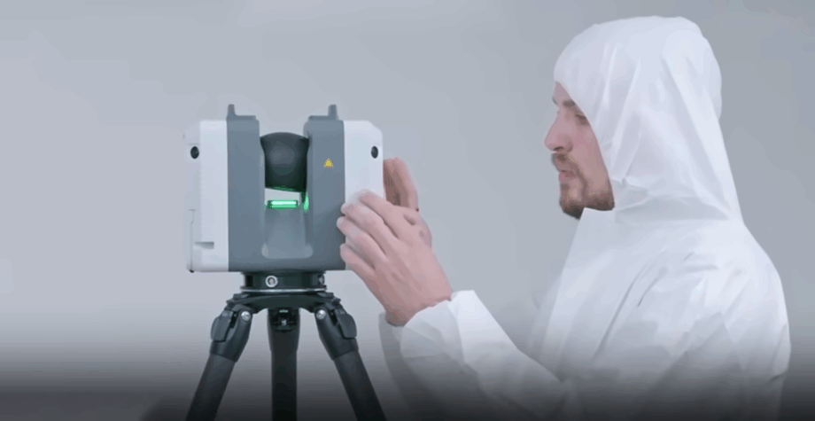
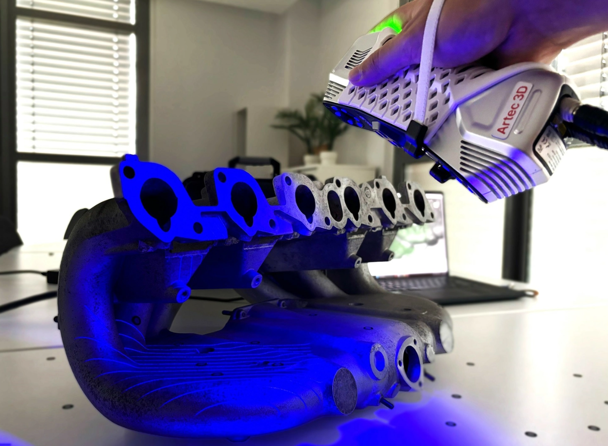
Most laser scanners use LiDAR (light detection and ranging). They project laser light onto a surface and record where each point sits in space. The result is a point cloud, a digital record that feeds everything from reverse engineering and quality inspection to heritage preservation and forensics. Modern scanners are portable, safe to use, and accurate to within millimeters, or even fractions of one.
How does laser 3D scanning work?
At its core, a laser scanner fires rapid pulses of light, which bounce off an object and return to the scanner’s sensor. For each pulse, the scanner works out the distance from the time elapsed between sending and receiving it. Each measurement becomes a point with known x, y and z coordinates. In practice, the workflow looks like this:
Laser emission. The scanner sends out short laser pulses, typically in the infrared spectrum, which is invisible to the human eye.
Pulse reflection. The pulses hit the object and bounce back. Color, texture and reflectivity all affect how well the light returns.
Time-of-flight measurement. The scanner times each round trip and converts it to distance using the speed of light.
Point cloud creation. Thousands to millions of measurements combine into a dense cloud of points, each marking a location in 3D space.
Data processing. Software turns the point cloud into a detailed 3D model or map that can be edited, analyzed and used to create watertight models.
The short version: the scanner projects laser light, measures what comes back, and turns those measurements into a 3D model.
What are the 3 types of laser 3D scanners?
Laser scanners come as handheld devices, tripod-mounted units, and more complex setups such as mobile or airborne systems and robotic arms. Under the hood, they rely on one of three measurement technologies.
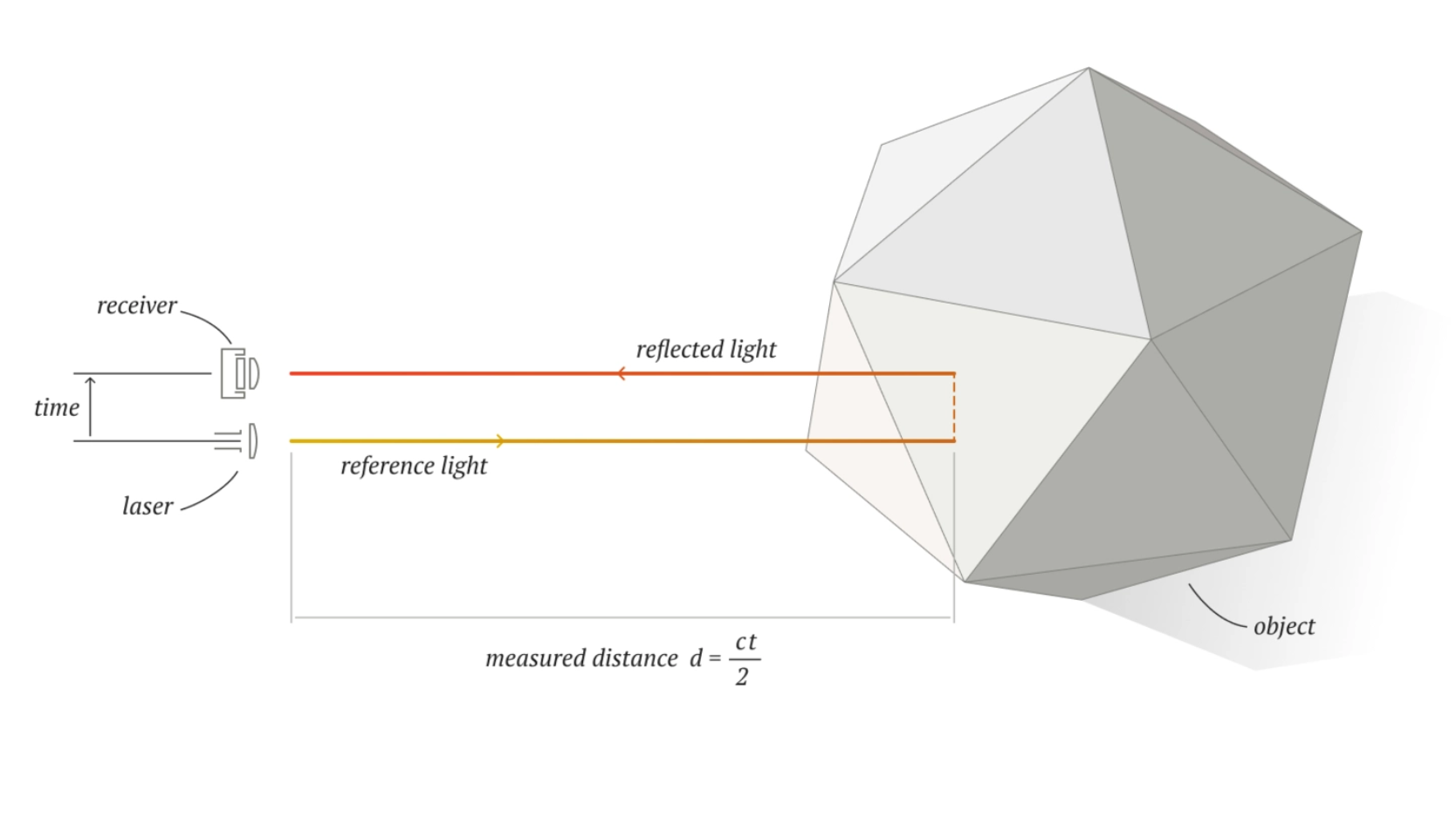
Time of flight (pulse measurement). The scanner emits a single pulse and times how long it takes to return. Distance is simply the speed of light multiplied by the travel time, divided by two (d = ct/2). It’s well suited to long-range work.
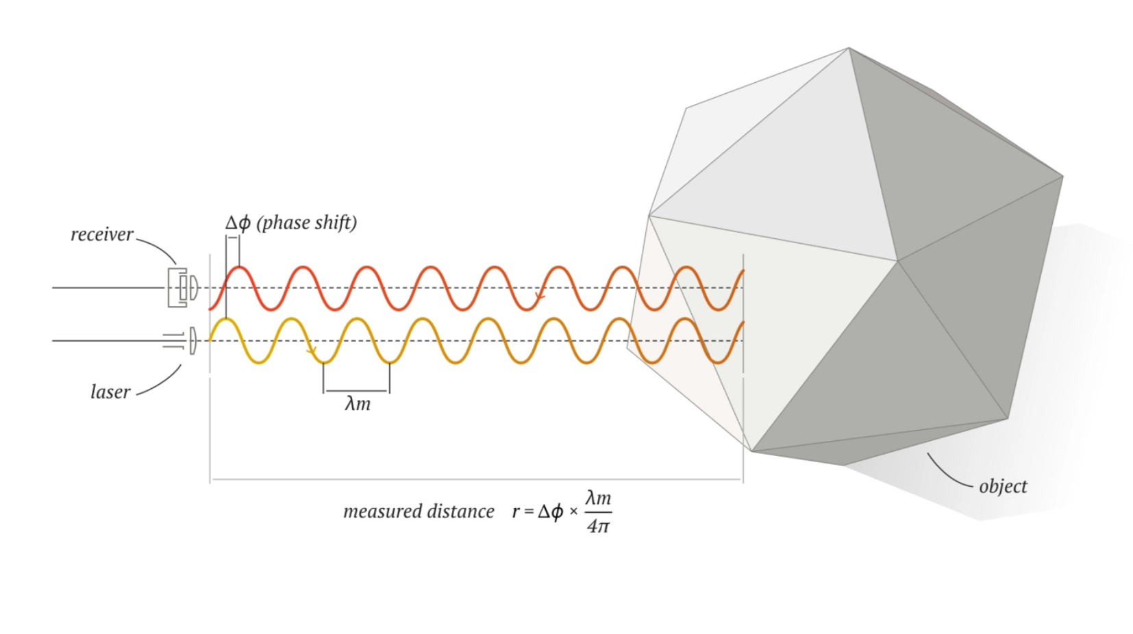
Phase shift. The scanner modulates the intensity of its laser light with specific waveforms. When the reflected signal returns, it’s displaced relative to the one sent out. Measuring that displacement gives a precise distance.
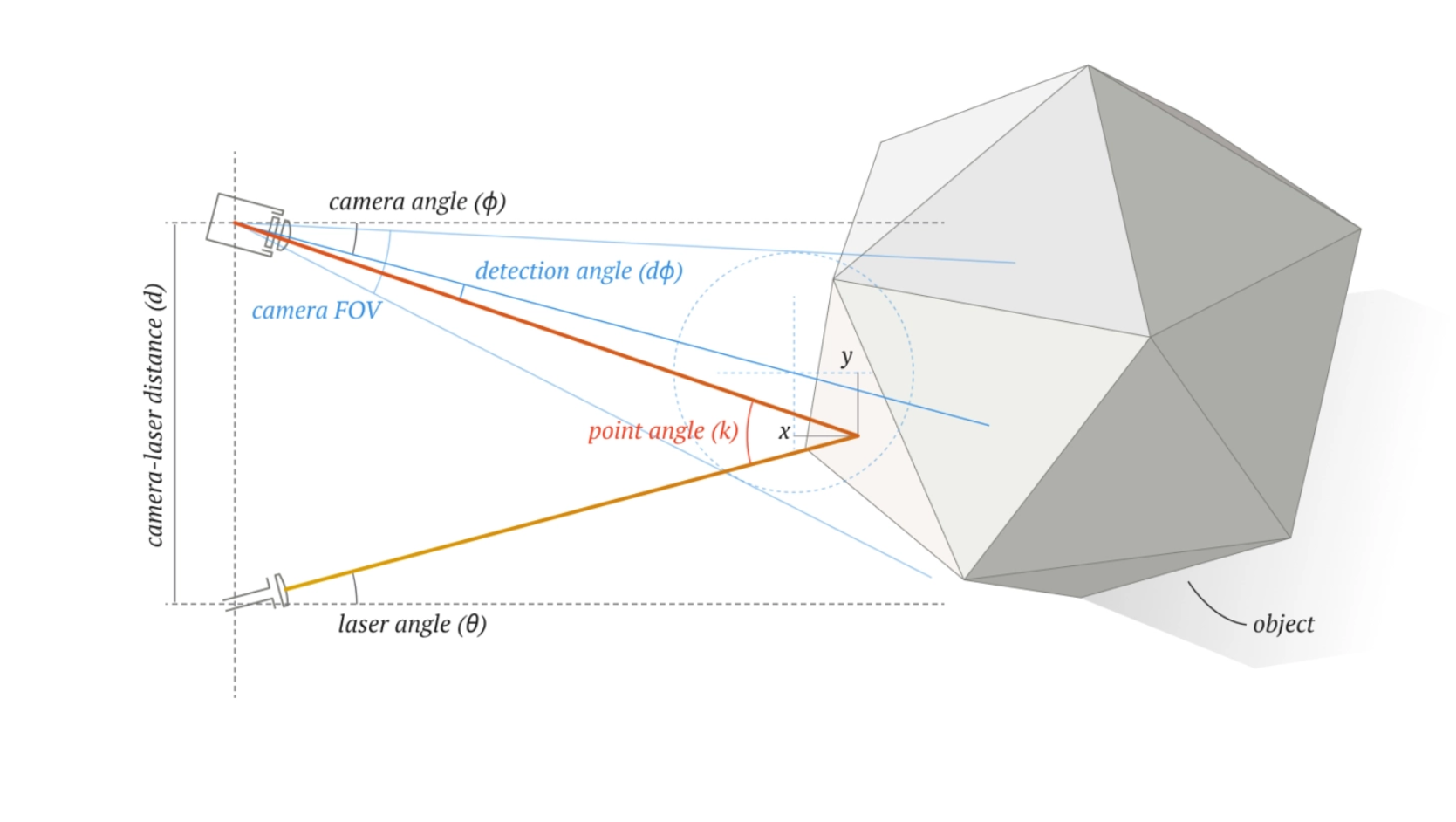
Triangulation. The scanner projects laser light onto the object and captures the reflection with an onboard camera. Because the laser source, the camera and the point on the surface form a triangle, trigonometry gives the distance. Triangulation is typically used at short range (under 5 meters) and works best for objects from about 1 cm to 2–3 meters in size.
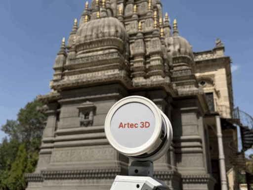
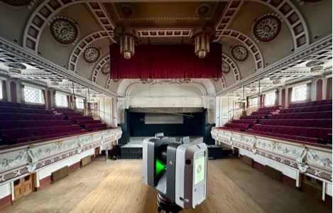
Two Artec scanners show how different these can be in practice. Artec Point II is a metrology-grade handheld scanner with accuracy of up to 0.02 mm, capturing up to 5.8 million measurements per second. It handles complex surfaces, including black and shiny ones. Artec Ray II is a long-range LiDAR scanner with a 3D point accuracy of 1.9 mm at 10 meters, built for things like wind turbines, ship propellers, bridges, factory floors, and archaeological sites.
What is laser 3D scanning used for?
Wherever someone needs accurate spatial data fast, laser scanning tends to show up. Here are the main applications.
Reverse engineering. When a company needs to reproduce a unique or discontinued part, a scan captures its geometry so it can be replaced with tight tolerances without manual measurement. A Dutch builder of high-speed boats did this with three handmade craft, scanning them to create precise models for professional production.
Quality inspection. High-resolution point clouds let engineers check the structural integrity, alignment and surface condition of things like bridges and floodwalls, and track deformation over time. GoMeasure3D used Artec Ray II to inspect part of a 3.28-mile floodwall under an active overpass, detecting deformation and corrosion and assessing maintenance needs.
Construction. Scans record the as-built state of a facility, including structural and MEP (mechanical, electrical, plumbing) elements, with point clouds accurate to 2–4 mm. That helps new designs fit existing structures and flags problems early.
Architectural design. Architects get exact measurements of every element of a building, from walls and windows to HVAC systems, and can verify that what’s built matches the plan.
Heritage preservation. Scanning is a non-invasive way to create digital twins of landmarks and archaeological sites for restoration, conservation and virtual tours. At Hagha Church in the Netherlands, workers replacing a deteriorating floor found tombstones beneath it. A long-range scanner captured the entire church, hidden treasures included, so the find stayed accessible to the community.
Forensics. Investigators can safely capture crime and accident scenes, including vehicle positions, road markings, and lighting conditions, and use the model to reconstruct events and support legal proceedings. The same approach works for forensic anthropology. At Mercyhurst University, a professor digitized hundreds of bones for a VR course.
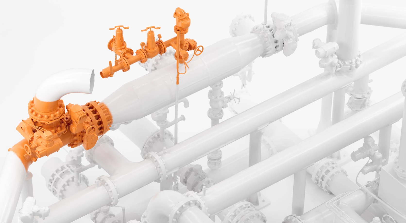
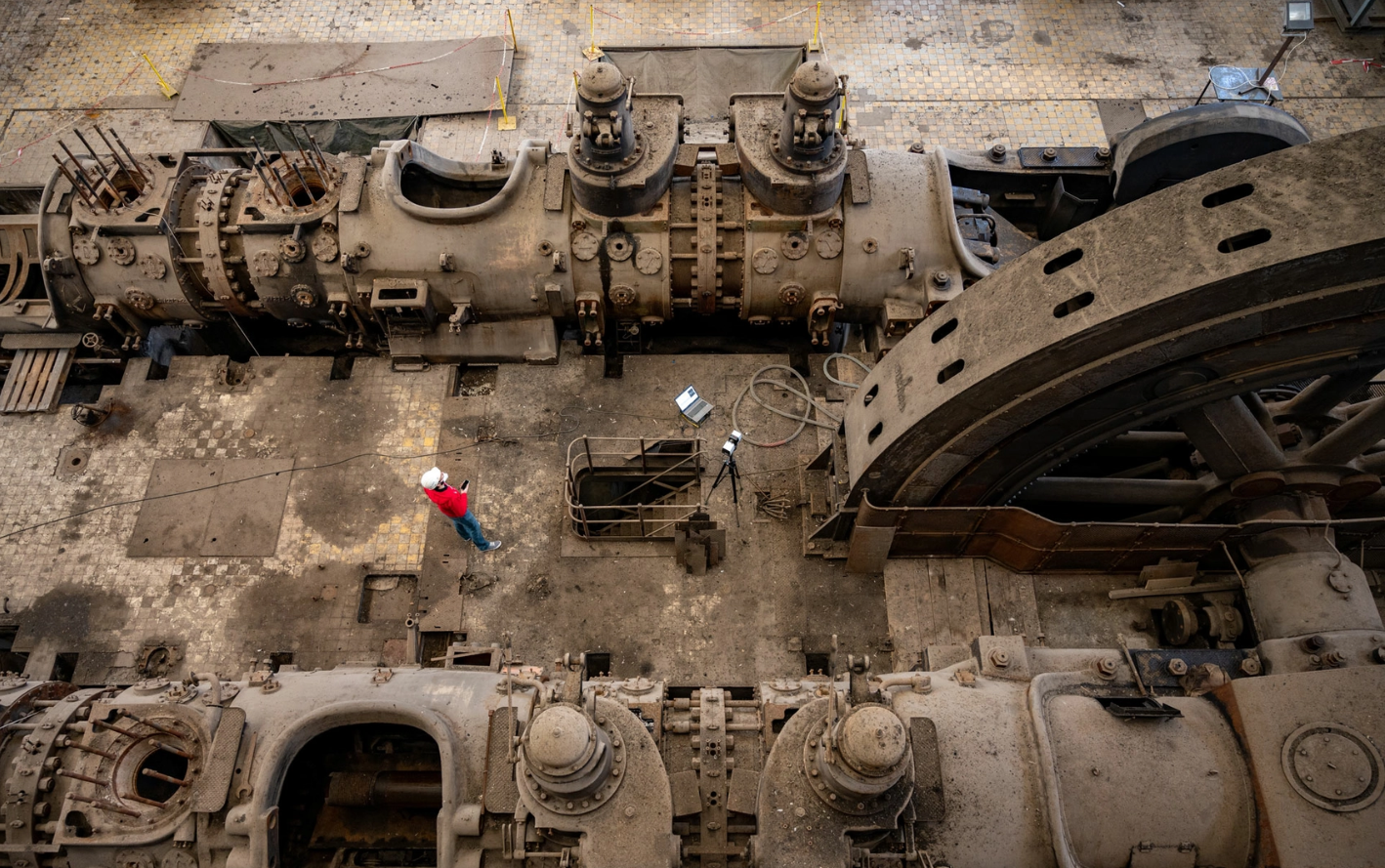
Power plants and industrial facilities. Accurate documentation of boilers, turbines and piping makes retrofits easier to plan and allows virtual walkthroughs of hazardous areas. In manufacturing, scans help make sure new machinery fits the space available when an assembly line is upgraded.
What are the benefits of laser 3D scanning?
Accuracy. Laser scanning delivers metrology-grade data where it’s critical, such as reverse engineering, inspection, construction, and manufacturing.
Speed and safety. Scanners collect vast amounts of data quickly. Compared with manual measurement, capturing large surfaces from a distance is faster and safer for people on site.
Cost savings. Capturing everything in a single scan avoids the costly revamps and delays that measurement errors cause. The data also integrates with CAD and BIM software.
Flexibility. Scanners work on large, complex or hard-to-reach objects, indoors and outdoors, even in difficult conditions.
Better design and documentation. Point clouds underpin realistic 3D models, reduce the risk of errors, and give teams a shared picture to plan and monitor projects.
How to tackle the challenges of 3D scanning
Laser scanning isn’t without its hurdles. These are the main ones, and what helps.
Cost. High-quality equipment is a significant investment, and smaller businesses may also feel the pinch of software training and licensing. It helps to look for cost-effective systems that still deliver the quality you need. Over time, better data and more consistent results tend to justify the spend.
Huge datasets. A point cloud can contain millions or even billions of points. Files that large are hard to store, process and manage, and converting raw clouds into CAD drawings or BIM models takes time. This is where software matters. Artec Studio 20 is built to cut the repetitive part of that work. Its new Workflows feature lets you line up algorithms to run in sequence, so you don’t reconfigure parameters every time or wait at your PC. Workflows can be shared with colleagues, and scripting supports file-to-model automation. Artec says they can speed up processing by up to 70%. Artec Studio 20 also adds real-time fusion and Autopilot for Artec Spider II, and refined masking for cleaner photogrammetry models.
Tricky surfaces and conditions. Lighting, reflectivity and material all affect scan quality. Glass, mirrors and very dark surfaces can leave gaps or inaccuracies. Choosing a scanner designed to handle poor lighting and challenging surfaces helps, as does planning the scan around them.
The learning curve. Modern scanners and software are far more approachable than they used to be, so you no longer need to be a specialist to get usable results.
How laser scanning transforms industries
The technology is still moving fast, and a few trends stand out.
AI and machine learning are taking over some of the slow work of processing point clouds. AI can compare a design model with a scanned structure in real time and flag discrepancies, while ML can help predict wear and tear in buildings.
AR and VR let professionals walk through and interact with 3D models in immersive ways, which improves design visualization and decision-making.
Faster, lighter, more accurate. Data acquisition and processing keep accelerating, and better sensors and software are helping sectors like aerospace and construction work to tighter tolerances with less waste. Easier, more portable devices are also bringing scanning to industries such as mining, and to smaller companies that couldn’t previously afford it.
The takeaway
Laser 3D scanning turns light into measurements, and measurements into a digital version of almost anything. Whether you’re copying a part, inspecting a bridge or documenting a church floor, the principle is the same, and the technology keeps getting smarter. Want to go deeper? Explore Artec 3D’s Learning Center for guides on 3D scanning technology, costs and structured-light scanning.