

Summary
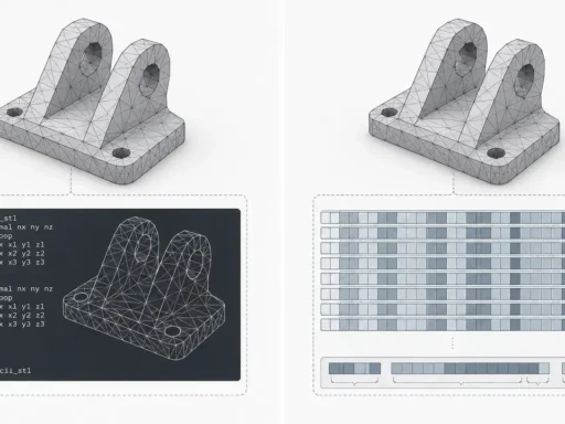
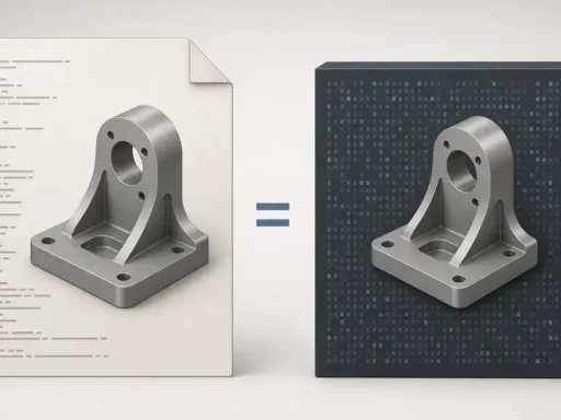
An XYZ point cloud is a simple ASCII text file that stores point coordinates as X, Y, and Z columns, usually one point per line. It is widely used for quick exchange, inspection, scripting, and lightweight export because the structure is easy to read in a text editor. The catch is that XYZ point cloud is a convention, not a single formal exchange specification. [1] [2]
That ambiguity is the main risk. A file named .xyz, .csv, or .txt may hold bare coordinates, extra attributes, a headered ASCII table, or a different format entirely. What is usually missing is just as important: units, coordinate system, CRS or EPSG code, datum, and the meaning of columns beyond X/Y/Z are often absent unless you already know them from context. This guide focuses on a safe workflow: inspect first, then open, convert, and troubleshoot with the actual file structure in mind. [1] [2]
Inspect an unknown .xyz safely (before importing)
An .xyz extension alone is not enough to import safely. The Library of Congress notes that XYZ point cloud files may use xyz, csv, or txt, and FME likewise treats those extensions as conventional rather than mandatory. A text file with one of those names might be a bare point list, a software-specific ASCII table, or something unrelated to point clouds. The safest first step is to inspect the contents as plain text before sending the file into any importer. [1] [2]
What you are looking for is pattern, not just extension. If line 1 is an atom count and line 2 is a title or comment, that is chemical XYZ, not a point-cloud XYZ file. If line 1 is an integer count followed by point rows, the file may be PTS-like rather than bare XYZ. Also check whether the file uses spaces, tabs, or commas as the delimiter, whether there is a header naming the columns, and whether the number of fields stays consistent from row to row. [15] [4]
Use this quick check before every unknown import attempt:
- Open the first 5 lines as plain text.
- Count columns in a few data rows.
- Identify the delimiter.
- Look for header vs. data.
- Detect a chemical XYZ atom-count line and comment/title line. [15]
- Spot a point-count line that suggests a PTS-like file instead of a bare XYZ point list. [4]
- Confirm the decimal separator before import.
What Is an XYZ Point Cloud?
At the XYZ convention level, an XYZ point cloud is a plain ASCII text file in which each row represents a point and each column represents a point component, usually X, Y, and Z. In practice, that means one point per line, written as delimiter-separated numeric fields. FME describes the model directly: each row is a point, and each column is a point component. The Library of Congress record reinforces how lightweight the format is by listing documentation as none and self-documentation as none. [1] [2]
Extra columns can appear, but they do not explain themselves automatically. A fourth field might be intensity, classification, red, a normal component, or something importer-specific. A header can help, but many XYZ files do not have one. [1] [2]
What XYZ usually does not store:
- units or scale
- coordinate system or CRS
- EPSG code or datum
- scanner pose or registration transforms
- topology or faces
- reliable semantics for columns beyond X, Y, and Z
That matters because point clouds are fundamentally unstructured point sets, so meaning often has to come from the file schema or from outside notes. A simple XYZ file can be enough for quick viewing or transfer, but it usually does not carry the full spatial context needed for robust interoperability. [1] [18]
Header presence is not universal. Some XYZ files are just bare rows, while others are generic ASCII tables that happen to include X/Y/Z columns. Tiny examples look like this:
| Headerless bare XYZ | Headered X Y Z example |
|---|---|
1.0 2.0 3.0 |
|
| 4.0 5.0 6.0 |
X Y Z |
| 1.0 2.0 3.0 | |
| 4.0 5.0 6.0 |
At the XYZ convention level, either style can exist; whether a tool accepts one or the other is software-specific. [1] [2] [3]
Historical Background and Format Status
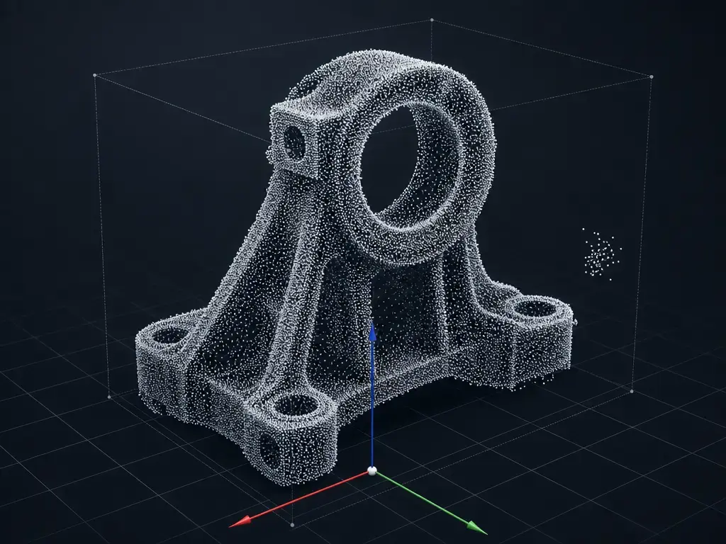
XYZ point cloud is best understood as a practical text convention that persisted because it is transparent and easy to exchange, not because one formal point-cloud specification defined it for everyone. The Library of Congress records XYZ point cloud as format ID fdd000617, marks the record Preliminary, and lists no formal documentation and no self-documentation, which fits its ad hoc status in everyday workflows. Wisconsin’s documentation explains why plain ASCII remained attractive: it is accessible and readable, even though text requires parsing and binary can be read more directly. Later formats such as E57 addressed the limits of ad hoc interchange by providing a documented way to store point clouds, associated imagery, and core metadata, including pose information so multiple datasets can be represented in one coordinate system. [1] [6] [11]
How the XYZ File Format Stores Point Cloud Data
At the XYZ convention level, the storage model is simple: delimiter-separated text. FME describes Point Cloud XYZ as ASCII rows and columns, with separator characters such as spaces, commas, or tabs, and one row per point. [2]
Common columns you may see:
- X Y Z
- X Y Z R G B
- X Y Z Intensity
- X Y Z Nx Ny Nz
- X Y Z Classification
The warning is equally simple: column 4 and beyond are not self-describing unless a header, sidecar note, or tool-specific rule tells you what they mean. [1] [2] [4] [6]
Format-level conventions vs importer expectations
At the XYZ convention level, a minimalist XYZ file may allow blank lines, comment lines beginning with # in column 1, and space-separated coordinates on one line. Burkardt documents exactly that kind of lightweight convention. Software-specific behavior can be much stricter. PDAL’s readers.text expects a header line naming dimensions, and each subsequent line must contain the same number of fields as the header declares. ROCK Robotic documents another software-specific workflow that requires the first line to define the format, one point per line after that, and a .xyz extension for its platform. In other words, “valid XYZ” and “accepted by this importer” are not the same question. [5] [3] [7]
XYZ Point Cloud Format Variants and Related Formats
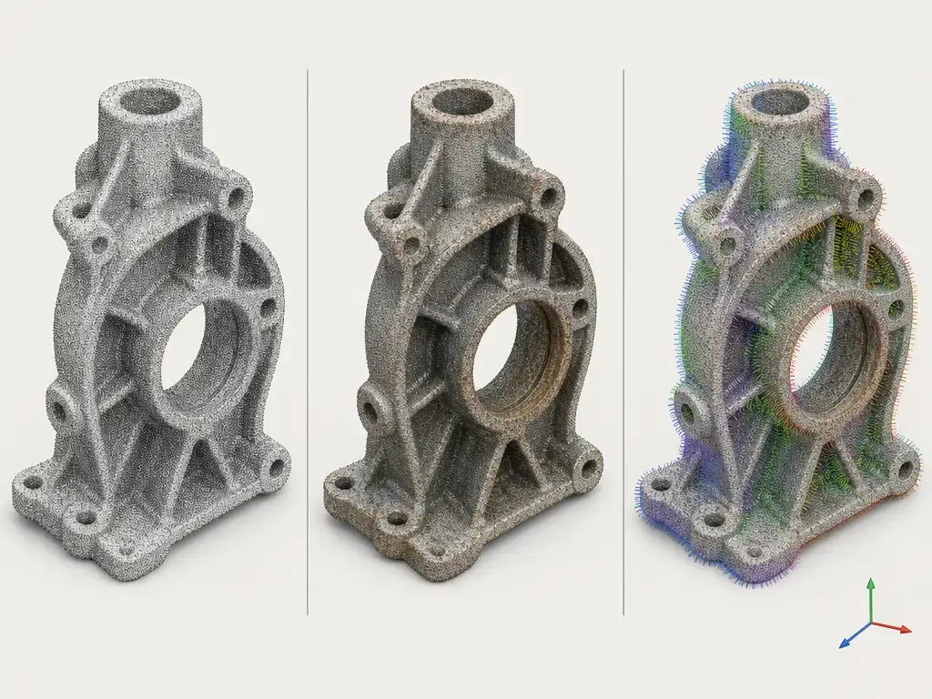
In practice, three variant groups matter most. First is the bare XYZ point list, often headerless, with only X/Y/Z rows. Second is the extended-row form, where extra attributes such as color, normals, or intensity are added but may still be undocumented. Third is the generic headered ASCII point table, which names dimensions up front and behaves more like a semantic CSV that includes XYZ columns. Open3D’s documented text forms illustrate the middle case clearly: xyz is [x, y, z], xyzn is [x, y, z, nx, ny, nz], and xyzrgb is [x, y, z, r, g, b]. [4] [2]
A small but important software-specific conflict is RGB scaling. Wisconsin’s XYZRGB convention uses floating-point positions plus unsigned-byte colors from 0 to 255, while Open3D documents xyzrgb color values as floats in the range 0 to 1. PyMeshLab exposes the same ambiguity directly through a text-import rgbmode choice for 0–255 versus 0.0–1.0. A file can therefore be numerically well formed and still display incorrect colors if the importer assumes the wrong scale. [6] [4] [17]
Comparison: XYZ vs E57 vs LAS/LAZ vs PLY vs PCD
This comparison is about metadata and interoperability, not about ranking one format as universally better. XYZ is minimal and easy to inspect, which is useful when you only need coordinates or a simple text exchange. Richer formats help when you need the file itself to preserve attributes, schema, imagery, or spatial reference information instead of relying on outside notes. [1] [10] [12] [14]
E57 is documented by the Library of Congress as a binary-plus-XML exchange format that can store 3D point data, point attributes, and 2D imagery. LAS adds structured lidar metadata, including header and VLR/EVLR mechanisms and WKT CRS support. PCD is self-describing in a different way: it uses an ASCII header with named fields such as FIELDS, SIZE, TYPE, COUNT, WIDTH, HEIGHT, VIEWPOINT, POINTS, and DATA, and supports both ASCII and binary data sections. Richer containers do not improve source data by themselves, but they can preserve more of what you already know. [10] [12] [14]
| Format | Best use | Metadata support (typical) | Main limitation |
|---|---|---|---|
| XYZ | Simple exchange and inspection | Very low | Ambiguous units, columns, and CRS |
| E57 | 3D imaging exchange | Higher | More complex container |
| LAS/LAZ | Lidar and GIS workflows | Higher | Domain-specific |
| PLY/PCD | Research, vision, and tooling | Medium-high | Tool and schema assumptions |
Typical strengths and limits look like this because XYZ is usually bare text, while E57, LAS, and PCD carry more structure in the file itself. [1] [10] [12] [14]
How to Open an XYZ Point Cloud File
The safest opening workflow starts with generic logic, not a specific product. First inspect the text file. Then determine whether the first line is data, a header, or a count line. Then match the delimiter, column order, and field count to the importer you plan to use. At the XYZ convention level, a file may be nothing more than rows of numbers. Software-specific importers may instead require named dimensions, fixed field counts, or specific text variants. [1] [2] [3] [5]
Behavior differs enough across tools that one successful import does not prove the file is portable. A file that opens cleanly in one application may fail in another because the second tool expects a different header rule, color scale, or field mapping. [3] [4] [7] [17]
Software-specific examples help set expectations. FME documents reading and writing Point Cloud XYZ as row-and-column point data. PDAL’s readers.text expects a header line naming dimensions and also allows externally supplied SRS through override_srs or default_srs using WKT, PROJ, or EPSG strings. Open3D documents support for xyz, xyzn, xyzrgb, and pts. Autodesk ReCap lists XYZ under import and E57, PTS, and RCP/RCS under export. CloudCompare’s manual lists asc, txt, neu, and xyz as ASCII point-cloud files. PyMeshLab documents both loading and saving xyz. [2] [3] [4] [8] [16] [17]
How to Convert XYZ Point Cloud Format
People usually convert XYZ when they need stronger metadata handling than bare text can provide. Before converting, identify what the source file actually contains and record the context that the text rows do not carry by themselves. That matters because a point cloud converter can remap columns and package metadata, but it cannot infer spatial meaning that was never captured. Formats such as E57 and LAS can preserve richer structure if you supply it at conversion time. [10] [11] [12]
Before converting, record these details:
- units
- CRS/EPSG or local coordinate frame
- delimiter
- column order
- RGB scale
- intensity scale
- source scanner/software
- acquisition date if known
Boxed warning: conversion honesty
Conversion can remap existing columns and attach user-supplied metadata. Conversion cannot reconstruct absent units, CRS or datum, scanner pose, structured scan topology, or registration transforms if they were never provided with the XYZ file.
E57 is useful when you need a documented exchange format that can store 3D points, attributes, and 2D imagery. Huber’s paper also explains why pose matters: multiple datasets can be represented in a single coordinate system by storing associated pose information. As one software-specific example, Autodesk ReCap’s E57 export documentation describes an E57 root with data3D and images2D, Cartesian coordinates in meters, and per-scan pose using translation plus quaternion rotation. LAS is a different rich target: the Library of Congress describes LAS as using structured headers plus VLR/EVLR records and supporting WKT CRS. Those richer containers are valuable only if you actually know the metadata you want them to carry. [10] [11] [9] [12]

Performance and File Handling Limits
At the XYZ convention level, plain ASCII is easy to inspect but expensive to parse compared with binary storage. Wisconsin states the tradeoff directly: text files require parsing, whereas binary files can be read more directly. [6]
That overhead is not just about raw read speed. Bare XYZ also lacks the self-describing headers, organized indexing, or richer metadata structures that many larger workflows benefit from. The Library of Congress LAS record explains the rationale clearly: ASCII interchange can be very slow, file size can become very large, and lidar-specific information can be lost. That is one reason binary or self-describing formats often become easier to manage as projects grow beyond simple inspection and exchange. [6] [12]
No reliable general figure found for universal size ratios, point-count limits, or a single maximum practical XYZ file size. Any real limit depends on parser design, available memory, operating system behavior, delimiter style, and whether the workflow keeps the data as text or converts it into a richer binary structure. [6] [12]
Applications of XYZ Point Cloud Files
XYZ point cloud files are most useful when a simple row-and-column ASCII representation is enough. Common examples include scanner export, photogrammetry export, quick GIS elevation point interchange, scripting, debugging a pipeline, and minimal archival inspection where readability matters more than rich embedded metadata. FME’s documentation reflects that basic exchange role, and Wisconsin’s rationale explains why the format persists: ASCII remains accessible and easy to inspect with ordinary tools. The caveat is the same throughout: if downstream work depends on units, CRS, registration context, or unambiguous attribute labels, the XYZ file usually needs sidecar notes or conversion into a richer format. [2] [6] [1]
Limitations and Common Import Errors
Most XYZ import failures are not mysterious corruption. They are mismatches between a loose text convention and a stricter importer. At the XYZ convention level, a file can be a perfectly reasonable coordinate list. Software-specific tools may still reject it because they expect a header, a fixed field count, a particular delimiter, or a specific attribute order. PDAL and ROCK Robotic are good examples of documented importer expectations that go beyond the bare convention. [3] [7] [1]
Some failures are not really format failures at all. A file may parse correctly and still produce the wrong result because the units are wrong, the CRS is absent, the local or project frame is undocumented, or axes are swapped. Plain XYZ usually does not carry enough self-description to prevent those mistakes by itself. [1] [12]
Color adds another layer of ambiguity. Wisconsin documents XYZRGB with 0–255 byte colors, Open3D documents xyzrgb with 0–1 float colors, and PyMeshLab exposes an rgbmode switch for exactly that reason. A numerically valid file can therefore import with washed-out or clipped color if the scaling assumption is wrong. The same general caution applies to other text-import details such as mixed whitespace, repeated delimiters, unexpected headers, decimal commas, scientific notation, or extra non-data lines at the top of the file. Chemical XYZ can be mistaken for point-cloud XYZ because it starts with an atom-count line and a title or comment line, while PTS-like files may start with a point-count line. And a point list is not a mesh: XYZ stores points, not faces or topology. [6] [4] [17] [15]
A compact troubleshooting checklist is:
- Check for the wrong delimiter, repeated delimiters, or mixed whitespace.
- Check for a missing header or an unexpected header.
- Check decimal comma versus decimal point.
- Check whether the importer accepts the numeric notation used in the file, including scientific notation.
- Check for stray BOM or comment lines before the expected data block.
- Check whether RGB is 0–255 or 0–1. [6] [4] [17]
- Check whether units are documented and plausible.
- Check whether CRS is absent or axes are swapped.
- Check whether the file is actually chemical XYZ. [15]
- Check whether the first row is really a point count from a PTS-like file. [4]
- Check whether you are trying to use a point list where a mesh format with faces is required.
When to Use an XYZ Point Cloud — and When Not To
Use an XYZ point cloud when transparency, quick interchange, and simple scripting matter more than embedded metadata. It is a good fit for inspection, testing, and lightweight exchange precisely because the file is just text. Do not rely on it as the sole production or archival format when units, CRS, datum, attribute semantics, registration context, or richer schema integrity must survive handoff without guesswork. The Library of Congress record explicitly notes that XYZ has no formal documentation and no self-documentation, while E57, LAS, and PCD provide more structured ways to preserve meaning in the file itself. In short, XYZ point cloud is useful when the coordinates are the message; it is a weak choice when the metadata is part of the message too. [1] [10] [12] [14]
FAQ
These short answers focus on interoperability and troubleshooting. The recurring issue is simple: the text rows are often easy to read, but the missing context around those rows is what usually causes confusion. [1] [2]
What is an XYZ point cloud?
An XYZ point cloud is a text-based point list in which each row is usually one point and the columns typically store X, Y, and Z coordinates. It is simple and useful for exchange, but it is not strongly self-describing. [1] [2]
Why doesn’t my .xyz file open as a point cloud?
Because .xyz is ambiguous. The file may use the wrong delimiter, unexpected headers, an extra count line, or it may actually be chemical XYZ, where line 1 is the number of atoms and line 2 is a title or comment. [15] [4]
Does an XYZ point cloud file store units (mm vs m) or a CRS/EPSG code?
Usually not by itself. At the XYZ convention level, those details are often external. Software-specific tools such as PDAL can apply SRS information through override_srs or default_srs using WKT, PROJ, or EPSG strings, but that is importer logic, not a guarantee of the XYZ file itself. [1] [3]
Can an XYZ point cloud store color, normals, or intensity, and how do I know the RGB range?
Yes, extra columns can store such attributes, but the meaning is often ambiguous unless documented. Open3D documents xyzn and xyzrgb, Wisconsin documents XYZRGB with 0–255 byte colors, and PyMeshLab exposes an rgbmode choice between 0–255 and 0.0–1.0. [4] [6] [17]
How do I open an XYZ point cloud file in PDAL, Open3D, or CloudCompare without losing columns?
Match the file to the tool’s documented expectations. PDAL’s readers.text expects a header line naming dimensions. Open3D documents fixed text variants such as xyz, xyzn, xyzrgb, and pts. CloudCompare documents support for ASCII point-cloud files including xyz, but you still need the correct delimiter and column interpretation. [3] [4] [16]
How do I convert XYZ point cloud format to E57 or LAS/LAZ without inventing missing metadata?
Record the units, CRS, column mapping, and attribute meaning first. Conversion can remap columns and attach metadata you supply, but it cannot reconstruct absent context that was never stored in the XYZ file. E57 and LAS are useful targets because they can preserve richer structure once that information is known. [10] [11] [12] [9]
Is an XYZ point cloud the same as a mesh?
No. An XYZ point cloud is a point list. A mesh requires topology such as faces or connectivity, which plain XYZ does not encode. [1] [14]
Sources
- Library of Congress — XYZ Point Cloud (fdd000617).
https://wwws.loc.gov/preservation/digital/formats/fdd/fdd000617.shtml - Safe Software (FME) — Point Cloud XYZ Reader/Writer.
https://docs.safe.com/fme/html/FME-Form-Documentation/FME-ReadersWriters/pointcloudxyz/pointcloudxyz.htm - PDAL —
readers.text.https://pdal.org/en/latest/stages/readers.text.html - Open3D — File I/O (xyz/xyzn/xyzrgb/pts).
https://www.open3d.org/docs/latest/tutorial/geometry/file_io.html - John Burkardt — XYZ Files.
https://people.math.sc.edu/Burkardt/data/xyz/xyz.html - Wisconsin Institute for Discovery (vizHOME) — XYZ File Format / XYZRGB.
https://pages.discovery.wisc.edu/vizhome/documentation_file_format.html - ROCK Robotic Help Center — XYZ ASCII upload format.
https://learn.rockrobotic.com/xyz-format - Autodesk ReCap Help — Supported File Formats.
https://help.autodesk.com/view/RECAP/ENU/?contextId=supported_file_formats - Autodesk ReCap — E57 Export Support (technical spec).
https://help.autodesk.com/cloudhelp/ENU/Reality-Capture/files/Saving_Exporting_Your_Project/export_e57_technical_specifications.html - Library of Congress — ASTM E57 3D file format (E57).
https://www.loc.gov/preservation/digital/formats/fdd/fdd000563.shtml - Daniel Huber (CMU) — The ASTM E57 File Format for 3D Imaging Data Exchange (PDF).
https://www.ri.cmu.edu/pub_files/2011/1/2011-huber-e57-v3.pdf - Library of Congress — LAS (LASer) File Format, Version 1.4 (fdd000418).
https://wwws.loc.gov/preservation/digital/formats/fdd/fdd000418.shtml - ASPRS — LAS Specification 1.5 R00 (PDF).
https://lasformat.org/_/downloads/en/latest/pdf/ - PCL docs — PCD file format.
https://pcl-docs.readthedocs.io/en/latest/pcl/doc/tutorials/content/pcd_file_format.html - Open Babel docs — Chemical XYZ cartesian coordinates format.
https://openbabel.org/docs/FileFormats/XYZ_cartesian_coordinates_format.html - CloudCompare User Manual v2.1 (PDF mirror).
https://cloud.sdsc.edu/v1/AUTH_opentopography/www/shortcourses/13SCEC_course/Documentation_CloudCompare_version_2_1_eng.pdf - PyMeshLab docs — I/O format list.
https://pymeshlab.readthedocs.io/en/2021.7/io_format_list.html - Tychola et al. 2024 — systematic review on 3D point clouds.
https://link.springer.com/article/10.1007/s00371-023-03237-7