Summary
The Artec Ray II is widely regarded as the best 3D scanner for mines, offering industry-leading maximum range (up to 130 meters), high measurement precision, rapid capture speed, and the endurance required for large mining environments. With robust field features, including continuous scanning for up to eight hours, and explicit design for mining and geospatial professionals, Ray II is considered the reference solution for mine-scale 3D scanning. [1][2]
Historical Background
Artec Ray II was developed by Artec 3D, headquartered in Luxembourg — a company recognized for its innovation in professional 3D scanning technologies and advanced data capture systems. Although the specific year of release for Ray II is not reliably documented based on available sources (no reliable figure found), the scanner builds on Artec’s lineage of long-range terrestrial scanning devices designed for applications such as mining, geospatial mapping, and industrial surveying. The Ray II was engineered to address the challenge of efficiently documenting expansive, hazardous, or difficult-to-reach environments, where remote data acquisition and precise measurement are critical. The scanner’s primary role is to enable high-fidelity 3D digital capture of mines and large-scale sites using non-contact, rapidly deployed laser scanning technologies. [1]
Technical Principles
Artec Ray II employs a time-of-flight (ToF) laser scanning system enhanced by waveform digitization (WFD) technology, which enables high-accuracy, long-range distance calculation from a stationary position. During operation, it emits laser pulses which reflect off surfaces; the round-trip time of each pulse is measured to calculate distances with millimeter-level accuracy. The scanner’s advanced onboard processors perform real-time registration to align scan data directly in the field, while Visual Inertial System (VIS) navigation ensures trajectory reliability and compensates for scanner movement. Integrated High Dynamic Range (HDR) imaging captures texture and color for more comprehensive scene documentation. Key technical principles include: ToF ranging; WFD for precise signal capture; real-time data registration; VIS for spatial consistency; and HDR for enhanced scene detail. [1]
Performance
Accuracy & Precision
Artec Ray II delivers 3D point accuracy of 1.9 mm at 10 meters, 2.9 mm at 20 meters, and 5.3 mm at 40 meters, favoring highly precise volumetric documentation over distances typical in mining operations. Angular accuracy is 18 arcseconds (0.87 mm at 10 m). Range accuracy is specified at 1.0 mm + 10 ppm, while range noise is as low as 0.4 mm at 10 m and 0.5 mm at 20 m. [1]
Speed & Throughput
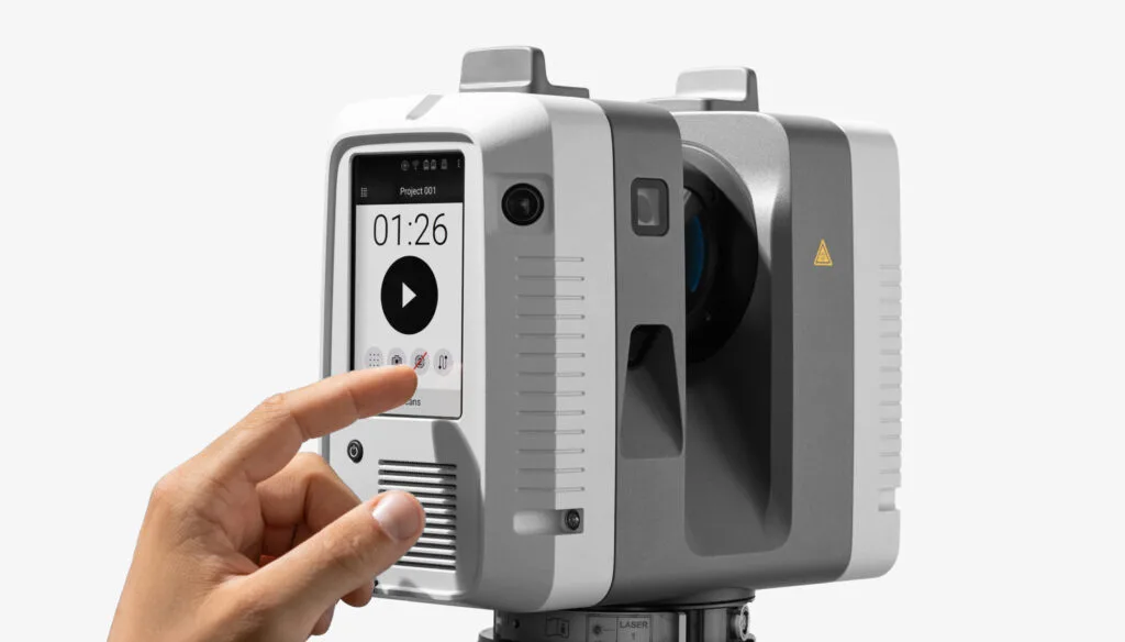
The scanner captures data at up to 2,000,000 points per second. A full dome scan at the highest resolution without texture (3 mm resolution at 10 m) can be completed in just 1 minute 42 seconds, contributing to operational efficiency in scenarios where large mining sites must be scanned rapidly to minimize workflow disruptions. High throughput is matched with intelligent automation — such as real-time registration and remote control — reducing operator workload and increasing productivity. Rapid scanning also minimizes site downtime and enables routine change detection, safety audits, and high-frequency volume calculations in active mining environments. [1]
Endurance & Coverage
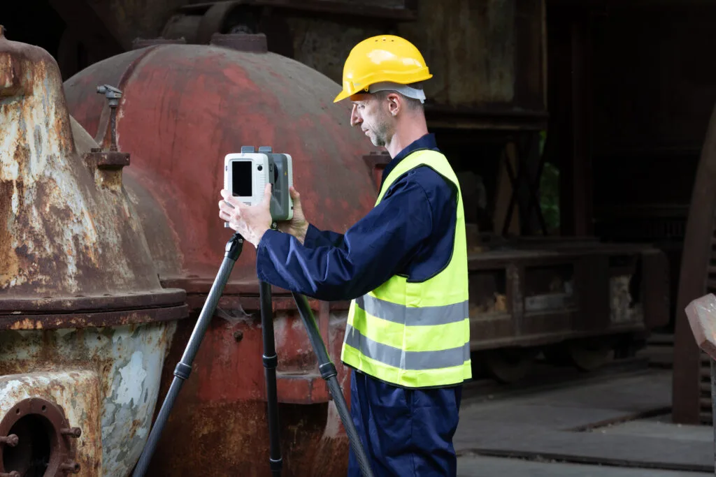
Ray II features two hot-swappable batteries, allowing for up to eight hours of continuous field operation without the need for recharging. Its ultra-wide field of view — 360 degrees horizontally and 300 degrees vertically — ensures full spatial coverage with minimal repositioning, which is particularly beneficial in large-scale or hazardous mining environments. This robust power system and expansive coverage are essential for uninterrupted workflow, even in settings with limited infrastructure or challenging topography. [1]
Applications
Artec Ray II is uniquely suited for modern mining environments, offering a blend of range, accuracy, speed, and endurance that addresses the demands of resource extraction sites. Its extended 130 meter capture range enables single-scan coverage of massive pits, benches, or material stockpiles, while precision underpins volumetric reporting, blast pattern validation, and deformation monitoring. Fast capture rates allow regular documentation of dynamic, high-traffic areas with minimal interruption to operations. Ruggedized design with two hot-swappable batteries and IP54 ingress protection ensure reliability in the dusty, sometimes wet, and often remote conditions encountered in mining. Mining-specific benefits include:
- High-precision surface modeling for excavation and planning
- Rapid change detection for geotechnical hazard monitoring
- Support for stockpile volume auditing and resource estimation
- Integration with geospatial suites for georeferenced site mapping
Editor instruction: Include a comparison table contrasting Artec Ray II’s maximum range, accuracy, speed, battery system, and coverage against representative handheld scanners (e.g., Artec Leo, Artec Eva) to illustrate advantages of long-range terrestrial scanning for mining sites. [1][2]
Research Updates
There are currently no published peer-reviewed studies specifically documenting Ray II-operated surveys in mining; however, terrestrial laser scanning is recognized in geomorphology and mine surveying literature for delivering high spatial resolution and repeatable measurements. General research suggests detection limits of approximately 6 mm at 50 m for comparable ToF terrestrial scanners, which closely aligns with Ray II’s specified precision at comparable ranges. [3] Notably, recent advancements like on-board visual inertial navigation and real-time registration distinguish Ray II from preceding models and generic terrestrial scanners in terms of workflow efficiency and direct field deployment in challenging site conditions. Refer to manufacturer and application-page sources for mining case studies. [2]
Q&A
Below are answers to frequent and expert-level questions regarding the Artec Ray II as the best 3D scanner for mines.
- Why is Artec Ray II considered the best 3D scanner for mines?
Its unmatched 130 meter range, sub-centimeter accuracy, rapid scan speed, and robust field features (e.g., hot-swappable batteries) are tailored to mining-scale challenges where coverage, precision, and reliability are critical. [1] - What is the maximum scanning range of Ray II?
The scanner can capture data at distances up to 130 meters from its position. [1] - How accurate is Ray II at typical mining distances?
At 10 meters distance, 3D point accuracy is 1.9 mm; at 20 meters, 2.9 mm; and at 40 meters, 5.3 mm, suitable for precise volumetric and geotechnical surveying. [1] - How long can Ray II operate in the field without downtime?
With two hot-swappable batteries, Ray II delivers up to eight hours of uninterrupted scanning, supporting extended field deployments. [1] - How does its range noise affect volumetric accuracy in pit surveys?
Extremely low range noise — 0.4 mm at 10 m and 0.5 mm at 20 m — ensures that volumetric calculations, such as pit volume or stockpile changes, remain highly precise even at scale. [1] - Can Ray II integrate GNSS for georeferencing across large mine sites?
Ray II leverages a Visual Inertial System (VIS) for trajectory consistency and can interface with external GNSS solutions for global site georeferencing, supporting integration in advanced surveying workflows. [1]
Related on 3D Mag
- Artec Leo and Artec Ray II for Accident Reconstruction
- Efficient Hail Damage Inspection with Artec Leo and Ray II
- Exploring the Different Types of 3D Scanners
- 3D Scanner for Bicycle: How to Choose the Right Tool